| Comprehensive Assessment of Water Supply in Maryland | 
|
| Comprehensive Assessment of Water Supply in Maryland |
|
Maryland Coastal Plain Aquifer Information: Hydrogeologic Framework: Andreasen, D.C., Staley, A.W., and Achmad, G.J, 2013, Maryland Geological Survey Open-File Report 12-02-20, 121 p.
A science plan for a comprehensive regional assessment of the Atlantic Coastal Plain aquifer system in Maryland: Shedlock, R.J., Bolton, D.W., Cleaves, E.T., Gerhart, J.M., and Nardi, M.R., 2007, U.S. Geological Survey Open-File Report 2007-1205, 25 p.
Sustainability of the ground-water resources in the Atlantic Coastal Plain of Maryland: Shedlock, R.J., and Bolton, D.W., 2006, U.S. Geological Survey Fact Sheet FS 2006-3009, 2 p.
Calvert Aquifer System Test Wells Located at Cordova, Talbot County, Maryland: MGS Fact Sheet 18a (PDF 1.3 Mb)
Calvert Aquifer System Test Wells Located at the Warner Tract, Dorchester County, Maryland: MGS Fact Sheet 18b (PDF 3.3 Mb)
Calvert Aquifer System Test Wells Located at Greensboro, Caroline County, Maryland, MGS Fact Sheet 18c (PDF, 4.0 Mb)
Calvert Aquifer System Test Wells Located at Idylwild Wildlife Management Area, near Federalsburg, Caroline County, Maryland: MGS Fact Sheet 18d (PDF 1.0 Mb)
Calvert Aquifer System Test Wells Located at Martinak State Park, Caroline County, Maryland: MGS Fact Sheet 18e (PDF 1.2 Mb)
Aquia Aquifer Test Wells Located near Church Hill, Queen Anne’s County, Maryland: MGS Fact Sheet 18f (PDF 2.0 Mb)
Manokin Observation Well Located in West-Central Wicomico County, Maryland: MGS Fact Sheet 18g (PDF 1.2 Mb)
Monmouth Aquifer Observation Well Located in Northern Kent County, Maryland: MGS Fact Sheet 18h (PDF 1.1 Mb)
A Science Plan for a Comprehensive Assessment of Water Supply in the Region Underlain by Fractured Rock in Maryland: Fleming, B.J., Hammond, P.A., Stranko, S.A., Duigon, M.T., and Kasraei, Saeid, 2012, U.S. Geological Survey Scientific Investigations Report 2012-5160,
29 p.
Selected Low-Flow Frequency Statistics for Continuous-Record Streamgage Locations in Maryland, 2010: Doheny, E.J.,and Banks, W.S.L., 2010, U.S. Geological Survey Open-File Report 2010-1310, 22 p.
Sustainability of the water resources in the Fractured-Rock Area of Maryland: Bolton, D.W., Gerhart, J.M., and Kasraei, S. 2009, U.S. Geological Survey Fact Sheet FS 2009-3009, 2 p.
A Hydro-ecological Assessment for Maryland’s Streams: DNR MANTA Fact Sheet (PDF 0.2 Mb)
Hydro-ecological Assessment, Management Questions: DNR MANTA Fact Sheet (PDF 0.7 Mb)
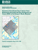 |
Increased groundwater withdrawals from confined aquifers in the Maryland Coastal Plain to supply anticipated growth at Fort George G. Meade (Fort Meade) and surrounding areas resulting from the Department of Defense Base Realignment and Closure Program may have adverse effects in the outcrop or near-outcrop areas. Specifically, increased pumping from the Potomac Group aquifers (principally the Patuxent aquifer) could potentially reduce base flow in small streams below rates necessary for healthy biological functioning. Additionally, water levels may be lowered near, or possibly below, the top of the aquifer within the confined-unconfined transition zone near the outcrop area. A three-dimensional groundwater flow model was created to incorporate and analyze data on water withdrawals, streamflow, and hydraulic head in the region. The model is based on an earlier model developed to assess the effects of future withdrawals from well fields in Anne Arundel County, Maryland and surrounding areas, and includes some of the same features, including model extent, boundary conditions, and vertical discretization (layering). The resolution (horizontal grid discretization) of the earlier model limited its ability to simulate the effects of withdrawals on the outcrop and near-outcrop areas. The model developed for this study included a block-shaped higher-resolution local grid, referred to as the child model, centered on Fort Meade, which was coupled to the coarser-grid parent model using the shared node Local Grid Refinement capability of MODFLOW-LGR. A more detailed stream network was incorporated into the child model. In addition, for part of the transient simulation period, stress periods were reduced in length from 1 year to 3 months, to allow for simulation of the effects of seasonally varying withdrawals and recharge on the groundwater-flow system and simulated streamflow. This required revision of the database on withdrawals and estimation of seasonal variations in recharge represented in the earlier model. The calibrated model provides a tool for future forecasts of changes in the system under different management scenarios, and for simulating potential effects of withdrawals at Fort Meade and the surrounding area on water levels in the near-outcrop area and base flow in the outcrop area. Model error was assessed by comparing observed and simulated water levels from 62 wells (55 in the parent model and 7 in the child model). The root-mean-square error values for the parent and child model were 8.72 and 11.91 feet, respectively. Root-mean-square error values for the 55 parent model observation wells range from 0.95 to 30.31 feet; the range for the 7 child model observation wells is 5.00 to 24.17 feet. Many of the wells with higher root-mean-square error values occur at the perimeter of the child model and near large pumping centers, as well as updip in the confined aquifers. Root-mean-square error values decrease downdip and away from the large pumping centers. Both the parent and child models are sensitive to increasing withdrawal rates. The parent model is more sensitive than the child model to decreasing transmissivity of layers 3, 4, 5, and 6. The parent model is relatively insensitive to riverbed vertical conductance; however, the child model does exhibit some sensitivity to decreasing riverbed conductance. The overall water budget for the model included sources and sinks of water including recharge, rivers and streams, general-head boundaries, and withdrawals from permitted wells. Withdrawal from wells in 2005 was estimated to be equivalent to 8.5 percent of the total recharge rate.
|
|
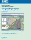 |
Incorporation of Water-Use Summaries into the StreamStats Web Application for Maryland Approximately 25,000 new households and thousands of new jobs will be established in an area that extends from southwest to northeast of Baltimore, Maryland, as a result of the Federal Base Realignment and Closure (BRAC) process, with consequent new demands on the water resources of the area. The U.S. Geological Survey, in cooperation with the Maryland Department of the Environment, has extended the area of implementation and added functionality to an existing map-based Web application named StreamStats to provide an improved tool for planning and managing the water resources in the BRAC-affected areas. StreamStats previously was implemented for only a small area surrounding Baltimore, Maryland, and it was extended to cover all BRAC-affected areas. StreamStats could provide previously published streamflow statistics, such as the 1-percent probability flood and the 7-day, 10-year low flow, for U.S. Geological Survey data-collection stations and estimates of streamflow statistics for any user-selected point on a stream within the implemented area. The application was modified for this study to also provide summaries of water withdrawals and discharges upstream from any user-selected point on a stream. This new functionality was made possible by creating a Web service that accepts a drainage-basin delineation from StreamStats, overlays it on a spatial layer of water withdrawal and discharge points, extracts the water-use data for the identified points, and sends it back to StreamStats, where it is summarized for the user. The underlying water-use data were extracted from the U.S. Geological Survey’s Site-Specific Water-Use Database System (SWUDS) and placed into a Microsoft Access database that was created for this study for easy linkage to the Web service and StreamStats. This linkage of StreamStats with water-use information from SWUDS should enable Maryland regulators and planners to make more informed decisions on the use of water resources in the BRAC area, and the technology should be transferrable to other geographic areas.
|
|
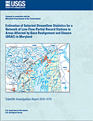 |
The U.S. Geological Survey, in cooperation with the Maryland Department of the Environment, operated a network of 20 low-flow partial-record stations during 2008 in a region that extends from southwest of Baltimore to the northeastern corner of Maryland to obtain estimates of selected streamflow statistics at the station locations. The study area is expected to face a substantial influx of new residents and businesses as a result of military and civilian personnel transfers associated with the Federal Base Realignment and Closure Act of 2005. The estimated streamflow statistics, which include monthly 85-percent duration flows, the 10-year recurrence-interval minimum base flow, and the 7-day, 10-year low flow, are needed to provide a better understanding of the availability of water resources in the area to be affected by base-realignment activities. Streamflow measurements collected for this study at the low-flow partial-record stations and measurements collected previously for 8 of the 20 stations were related to concurrent daily flows at nearby index streamgages to estimate the streamflow statistics. Three methods were used to estimate the streamflow statistics and two methods were used to select the index streamgages. Of the three methods used to estimate the streamflow statistics, two of them—the Moments and MOVE1 methods—rely on correlating the streamflow measurements at the low-flow partial-record stations with concurrent streamflows at nearby, hydrologically similar index streamgages to determine the estimates. These methods, recommended for use by the U.S. Geological Survey, generally require about 10 streamflow measurements at the low-flow partial-record station. The third method transfers the streamflow statistics from the index streamgage to the partial-record station based on the average of the ratios of the measured streamflows at the partial-record station to the concurrent streamflows at the index streamgage. This method can be used with as few as one pair of streamflow measurements made on a single streamflow recession at the low-flow partial-record station, although additional pairs of measurements will increase the accuracy of the estimates. Errors associated with the two correlation methods generally were lower than the errors associated with the flow-ratio method, but the advantages of the flow-ratio method are that it can produce reasonably accurate estimates from streamflow measurements much faster and at lower cost than estimates obtained using the correlation methods. The two index-streamgage selection methods were (1) selection based on the highest correlation coefficient between the low-flow partial-record station and the index streamgages, and (2) selection based on Euclidean distance, where the Euclidean distance was computed as a function of geographic proximity and the basin characteristics: drainage area, percentage of forested area, percentage of impervious area, and the base-flow recession time constant, t. Method 1 generally selected index streamgages that were significantly closer to the low-flow partial-record stations than method 2. The errors associated with the estimated streamflow statistics generally were lower for method 1 than for method 2, but the differences were not statistically significant. The flow-ratio method for estimating streamflow statistics at low-flow partial-record stations was shown to be independent from the two correlation-based estimation methods. As a result, final estimates were determined for eight low-flow partial-record stations by weighting estimates from the flow-ratio method with estimates from one of the two correlation methods according to the respective variances of the estimates. Average standard errors of estimate for the final estimates ranged from 90.0 to 7.0 percent, with an average value of 26.5 percent. Average standard errors of estimate for the weighted estimates were, on average, 4.3 percent less than the best average standard errors of estimate from the separate estimation methods.
|
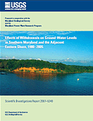 |
Ground water is the primary source of water supply in most areas of Maryland´s Atlantic Coastal Plain, including Southern Maryland. The counties in this area are experiencing some of the most rapid growth and development in the State, resulting in an increased demand for ground-water production. The cooperative, basic water-data program of the U.S. Geological Survey and the Maryland Geological Survey has collected long-term observations of ground-water levels in Southern Maryland and parts of the Eastern Shore for many decades. Additional water-level observations were made by both agencies beginning in the 1970s, under the Power Plant Research Program of the Maryland Department of Natural Resources. These long-term water levels commonly show significant declines over several decades, which are attributed to ground-water withdrawals. Ground-water-level trends since 1980 in major Coastal Plain aquifers such as the Piney Point-Nanjemoy, Aquia, Magothy, upper Patapsco, lower Patapsco, and Patuxent were compared to water use and withdrawal data. Potentiometric surface maps show that most of the declines in ground-water levels can be directly related to effects from major pumping centers. There is also evidence that deep drawdowns in some pumped aquifers may be causing declines in adjacent, unpumped aquifers. Water-level hydrographs of many wells in Southern Maryland show linear declines in levels year after year, instead of the gradual leveling-off that would be expected as the aquifers equilibrate with pumping. A continual increase in the volumes of water being withdrawn from the aquifers is one explanation for why they are not reaching equilibrium. Although reported ground-water production in Southern Maryland has increased somewhat over the past several decades, the reported increases are often not large enough to account for the observed water-level declines. Numerical modeling simulations indicate that a steady, annual increase in the number of small wells could account for the observed aquifer behavior. Such wells, being pumped at rates below the minimum legal reporting threshold of 10,000 gallons per day, might be the source of the additional withdrawals. More detailed water-use data, especially from domestic wells, central-pivot irrigation wells, and other small users not currently reporting withdrawals to the State, may help to determine the cause of the aquifer declines.
|
|
 |
The U.S. Geological Survey’s Groundwater Resources Program is conducting an assessment of groundwater availability throughout the United States to gain a better understanding of the status of the Nation’s groundwater resources and how changes in land use, water use, and climate may affect those resources. The goal of this National assessment is to improve our ability to forecast water availability for future economic and environmental uses. Assessments will be completed for the Nation’s principal aquifer systems to help characterize how much water is currently available, how water availability is changing, and how much water we can expect to have in the future. The concept of groundwater availability is more than just how much water can be pumped from any given aquifer. Groundwater availability is a function of many factors, including the quantity and quality of water and the laws, regulations, economics, and environmental factors that control its use. The primary objective of the Northern Atlantic Coastal Plain groundwater-availability study is to identify spatial and temporal changes in the overall water budget by more fully determining the natural and human processes that control how water enters, moves through, and leaves the groundwater system. Development of tools such as numerical models can help hydrologists gain an understanding of this groundwater system, allowing forecasts to be made about the response of this system to natural and human stresses, and water quality and ecosystem health to be analyzed, throughout the region. |
| Geology of the Marcellus Shale in Maryland, David K. Brezinski MGS Fact Sheet (PDF 1.65 Mb) | ||
 |
Water Resources and Natural Gas Production from the Marcellus Shale The Marcellus Shale is a sedimentary rock formation deposited over 350 million years ago in a shallow inland sea located in the eastern United States where the present-day Appalachian Mountains now stand. This shale contains significant quantities of natural gas. New developments in drilling technology, along with higher wellhead prices, have made the Marcellus Shale an important natural gas resource. The Marcellus Shale extends from southern New York across Pennsylvania, and into western Maryland, West Virginia, and eastern Ohio. The production of commercial quantities of gas from this shale requires large volumes of water to drill and hydraulically fracture the rock. This water must be recovered from the well and disposed of before the gas can flow. Concerns about the availability of water supplies needed for gas production, and questions about wastewater disposal have been raised by water-resource agencies and citizens throughout the Marcellus Shale gas development region. This Fact Sheet explains the basics of Marcellus Shale gas production, with the intent of helping the reader better understand the framework of the water-resource questions and concerns.
|
|
The Southern Maryland observation-well network comprises over 200 wells in which water levels are measured as part of a joint agreement with the Power Plant Research Program of the Maryland Department of Natural Resources, the Maryland Geological Survey, and the U.S. Geological Survey. Water levels measured in additional wells funded by other projects contribute data to this project. The wells are measured at least once per year in September when water levels are typically at a seasonal low. Potentiometric surface maps are produced for five of the most heavily pumped aquifers (Patuxent, Lower Patapsco, Upper Patapsco, Magothy, and Aquia aquifers) using the September measurements. These maps are prepared every two years. A link to the most recent set of maps is given below. These maps are used to help evaluate the response of aquifer water levels to groundwater withdrawals (including withdrawals from power plants at Calvert Cliffs--Aquia aquifer; Morgantown--Lower Patapsco aquifer; Chalk Point--Patuxent, Lower Patapsco, and Upper Patapsco aquifers; and, Panda-Brandywine, near Waldorf--Lower Patapsco aquifer). Mapping aquifer heads across a region and over time provides important information to help achieve long-term water-supply sustainability, and to minimize interference between groundwater users.
USGS SIR 2012-5165
Curtin, S.E., Andreasen, D.C., and Staley, A.W, Potentiometric Surface and Water-Level Difference Maps of Selected Confined Aquifers in Southern Maryland and Maryland’s Eastern Shore, 1975–2011, 36 p.