| Comprehensive Assessment of Water Supply in Maryland | 
|
Hydrogeologic Framework |
||
Maryland Geological Survey (MGS) scientists have been compiling the hydrogeologic framework for the Maryland Coastal Plain. The framework describes the spatial distribution of aquifers and confining units, and is based on data from hundreds of wells. In addition, targeted regional aquifer investigations are being conducted, which will serve to further refine the framework. Progress: Under Phase I of the Coastal Plain study, the structure of the Coastal Plain aquifers and confining units was defined using approximately 900 boreholes. Hydraulic properties of the hydrogeologic units were defined using approximately 730 aquifer tests from published reports and from files at the Maryland Department of the Environment (MDE). These data were incorporated into the GIS-based Maryland Coastal Plain Aquifer Information System (MCPAIS) in the form of surfaces (digital elevation models), point (borehole) data, and polygons (aquifer extent and outcrop/subcrop areas). The MCPAIS is currently in use by the MDE to aid in groundwater appropriation permitting decisions. An Open-File report documenting the hydrogeologic framework contained in the MCPAIS is currently in preparation. |
|
|
Regional Investigations |
||
Miocene-Age Aquifers on the Eastern Shore The Miocene-age Calvert aquifer system is an important water supply in Maryland's central Eastern Shore counties (Dorchester, Caroline, and Talbot), as well as central Delaware. It is uncertain whether this water-bearing zone acts as multiple independent aquifers or as a single hydraulic unit, and whether it correlates with units mapped in Delaware. These considerations are important in determining whether MDE groundwater appropriation permits should be issued for multiple aquifers or for a single composite aquifer. In 2010, MGS drilled five new well clusters in the Miocene-age sediments on the Eastern Shore. These test wells will help to assess the hydraulic characteristics of the Calvert aquifer system, and to determine the connectivity of the individual units. Additionally, the wells will be used to provide long-term water-level monitoring for resource management assessment, and to help calibrate groundwater-flow models. |
|
|
Fact Sheets for the Miocene investigation: Calvert Aquifer System Test Wells Located at Cordova, Talbot County, Maryland, 2011, MGS Fact Sheet 18a (PDF 1.3 Mb) Calvert Aquifer System Test Wells Located at the Warner Tract, Dorchester County, Maryland, 2011, MGS Fact Sheet 18b (PDF 3.3 Mb) Calvert Aquifer System Test Wells Located at Greensboro, Caroline County, Maryland, 2011, MGS Fact Sheet 18c (PDF 4.0 Mb) Calvert Aquifer System Test Wells Located at Idylwild Wildlife Management Area, near Federalsburg, Caroline County, Maryland, 2011, MGS Fact Sheet 18d (PDF 1.0 Mb) Calvert Aquifer System Test Wells Located at Martinak State Park, Caroline County, Maryland, 2011, MGS Fact Sheet 18e (PDF 1.2 Mb)
|
||
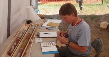
Potomac Group Aquifers in the Upper Chesapeake Bay Area The Cretaceous-age Potomac Group aquifers are an important water resource in the Upper Chesapeake Bay area. To obtain a better understanding of the sedimentology and flow system of this aquifer system, MGS drilled a 590 foot continuous corehole at Elk Neck State Forest in Cecil County in July, 2009. This corehole and other recent work by MGS in northern Cecil County will help determine how the aquifers are recharged and the extent to which they are confined as we define the relationship of the sediment layers of the Potomac Group to the underlying, impervious bedrock. |
 |
|