


Power Plant Observation-Well Network
Project Details
- Latest Reports:Potentiometric surface maps of selected confined aquifers in Southern Maryland and Maryland's Eastern Shore, 2019 Cumulative Environmental Impact Report (19th ed.)--Impacts to Water Resources (4.2)
- Project Staff: Andrew Staley Johanna Gemperline

Groundwater is the principal source of freshwater supply in most of Southern Maryland and adjacent Eastern Shore. It is also the source of freshwater supply used in the operation of the Calvert Cliffs, Chalk Point, and Morgantown power plants. Increased groundwater withdrawals over the last several decades have caused groundwater levels to decline. The Maryland Geological Survey (MGS) and the U.S. Geological Survey (USGS) have maintained a groundwater level monitoring network started in the 1940s to observe changes in groundwater levels through time.
Groundwater-level monitoring has been especially critical for Southern Maryland and adjacent Eastern Shore where groundwater is the primary source of water supply. Many observation wells were added to the network in the early 1970s following the establishment of the Power Plant Research Program (PPRP) of the Maryland Department of Natural Resources in order to monitor groundwater levels at Maryland power plants. Water-level data collected from the monitoring network and water-withdrawal data from the confined aquifers which supply water for the operation of Maryland’s power plants are used by the PPRP and the Maryland Department of Environment (MDE) Water Management Administration (WMA) to evaluate potential impacts of Maryland’s power plants on groundwater resources.
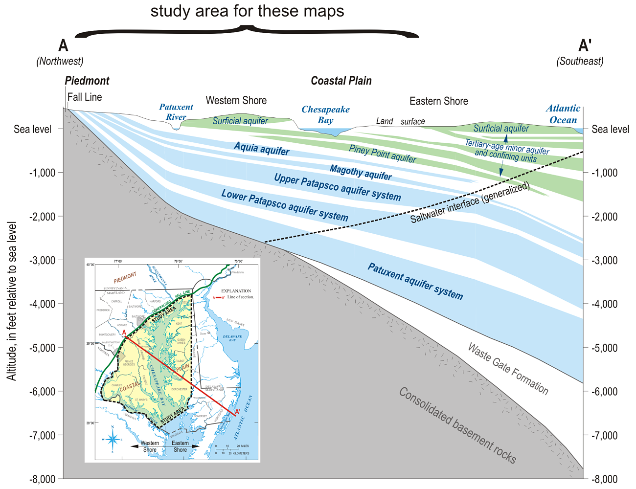
Long-term monitoring indicates a steady decline in water levels in the Aquia, Magothy, Upper Patapsco, Lower Patapsco, and Patuxent aquifers. While power plants have contributed to the decline in the water levels in these aquifers, increased withdrawals from municipal well fields in southern Maryland have caused most of the recent declines. The amount of water available in a confined aquifer is expressed as the aquifer’s “available drawdown,” which is defined in MDE regulations as 80 percent of the distance from the historic pre-pumping water level to the top of the pumped aquifer. To minimize impacts to municipal supplies, MDE WMA has required industrial users to utilize the deeper aquifers for new withdrawals.
Potentiometric surface and difference maps are typically generated every two years and published by the Maryland Geological Survey and the U.S. Geological Survey for five confined aquifers (Aquia, Magothy, Upper and Lower Patapsco, and Patuxent). Please check the "Project Details" box for the latest Maps, Data, or Reports.