Groundwater Science Priorities
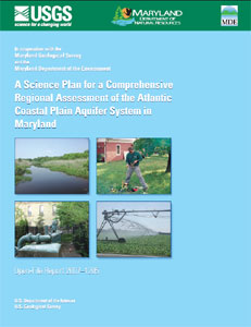
Coastal Plain
In 2007, a science plan was developed to address the recommendations of the Advisory Committee on the Management and Protection of the State's Water Resources ("Wolman Report"). Since that time approximately half of the goals outlined in the science plan have been met. To complete the effort and help insure a clean and adequate groundwater supply for the future of Maryland's citizens the following tasks should be completed:

Maintain and update the Aquifer Information System
MGS and USGS, with guidance from the Maryland Department of the Environment (MDE), developed a GIS-based aquifer information system to aid the MDE in assessing water-allocation permits. To maintain its effectiveness, the system should periodically be updated. As new wells are drilled more information becomes available to better define the aquifer system. It's critical that water-resource managers have the most up-to-date and pertinent information. It's particularly important to fill data gaps and to increase our understanding of aquifer systems in areas of greater hydrogeologic complexity, such as the Potomac Group in the upper Chesapeake Bay area. Also, the addition of other data layers, such as water use, water quality, and groundwater-levels, would greatly enhance the utility of the aquifer information system.
Regional groundwater-flow model
A significant deficiency in the current management of Maryland's groundwater resources is the inability to assess the cumulative impacts of the many thousands of pumping wells and to make predictions on future conditions. To remove this impediment to more effective resource management and planning, a regional groundwater-flow model needs to be developed. The model will simulate flow through the entire Coastal Plain aquifer system with the ability to focus on smaller areas. A comphrehensive, regional groundwater-flow model would provide the best means for assessing aquifer recharge and long-term resource sustainability.
Monitoring
A comprehensive set of groundwater-level data is needed to assess impacts of well withdrawals on the aquifer system and to help calibrate a regional groundwater-flow model. Currently, MGS and USGS maintain a network of monitoring wells across the State; however, data gaps exist in certain areas and aquifers. A sustained monitoring effort is critical to determine long-term impacts of withdrawals.
Water use
Determining how much water is being withdrawn from which aquifers is fundamental for assessing impacts on the resource. The Maryland Department of the Environment maintains a database of permitted withdrawals greater than 10,000 gallons per day, but the information needs to be made more easily accessible for analysis. Additionally, permitted withdrawals less than 10,000 gallons per day and domestic, self-supplied withdrawals need to be quantified.
Groundwater quality
Water quality is an essential component of water supply. Identifying areas of degraded water quality will help insure that Maryland's citizens are supplied with water of good quality. A significant amount of groundwater-quality data that could be very useful for water management are stored in federal, state, and local databases; however, the data may not be easily accessible. Developing a user interface to access the data spatially and with the correct aquifer assignments would be of great benefit.
Web-based aquifer information system
One of the key advancements made over the past several years is the development of an aquifer information system for the Coastal Plain aquifer system. This GIS-based system graphically displays the structure, extent, and hydraulic properties of the entire aquifer system in the Coastal Plain. The system is currently used as a desktop-tool by the MDE, but making it web-based would allow access to others with an interest in groundwater resources, including local government and other state agencies, consultants, well drillers, and the general public.
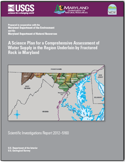
Fractured Rock Area
Study Goals
The goals of this study are broad and diverse. Groundwater, surface-water, biological, and water-quality expertise need to be integrated in a multidisciplinary approach to achieve the goals of the study. The U.S. Geological Survey (USGS), Maryland Department of the Environment (MDE), Maryland Geological Survey (MGS), and Maryland Department of Natural Resources (DNR) are the primary cooperating agencies with staff providing the expertise required to carry out the study.

Tools for Improved Management of Water Resources
Improved databases and geographic information systems (GIS) are needed to assist permit reviewers, scientists, planners, and other stakeholders to evaluate data related to water supply in the Fractured Rock region of Maryland. To address this need, the Fractured Rock Aquifer Information System will be developed. This GIS project will include relevant geologic, land use, and monitoring data, and incorporate new data and scientific products as they become available.
Factors Affecting Reliable Yields of Individual Water Supplies
A primary concern for water resource planners is the availability of groundwater during drought but, because the Fractured Rock region of Maryland is such a complicated geologic area with significant spatial variability in rock type and structure, assessing groundwater availability on a regional scale is difficult. As such, multi-disciplinary methods of investigation are needed to address issues of reliable yield in different areas of the state. Statistical methods will be applied to relate physical characteristics, well-construction information, and yields. Discrete down- hole geophysical techniques will be applied to production wells to better understand common geologic and structural attributes in higher yielding wells.
Potential Impacts to Other Water Users by Surface and Groundwater Withdrawals
MDE is responsible for the protection of water resources for the State of Maryland. One of their responsibilities is to prevent adverse impacts from one water user to another. This is especially complicated in the Fractured Rock region of Maryland because surface water and groundwater are so closely connected.
Potential Impacts of Withdrawals to Stream Flow and Aquatic Habitats
MDE has the responsibility to maintain minimum flows in Maryland streams to support aquatic habitat. To evaluate the health of aquatic habitat, streamflow-ecology relations will be identified using data from USGS streamgages and biological inventories maintained in the DNR's Maryland Biological Stream Survey (MBBS). At MBSS sites without USGS streamgages, daily streamflow will be estimated to develop streamflow-ecology relations. This analysis will include water withdrawals from streams and groundwater within the same drainage basin to investigate the potential impacts to stream ecology from permitted water allocations.
Improve Understanding of patterns of water-quality in aquifers and streams
In the Fractured Rock areas of Maryland, groundwater from individual domestic wells is a significant source of potable water for much of the population. Water-quality constituents for domestic groundwater supplies vary by rock type and land-use practices. Naturally-occuring radionuclides and metals, such as arsenic, are sometimes present in groundwater above the U.S. Environmental Protection Agency's Maximum Contaminant Levels. Patterns in groundwater and surface water will be evaluated using existing data from federal, state, and local databases.


